More wet weather on the way after storms lash Brisbane
Résumé détaillé
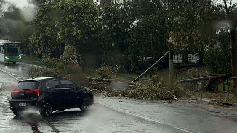
Tens of thousands of people remain without electricity and 11 schools are closed after storms battered south-east Queensland on Wednesday night, tearing down trees onto traffic…
Brisbane may not be out of the woods just yet, with more wet weather possible a day after destructive storms swept the city.
Warnings were issued for south-east Queensland by the Bureau of Meteorology before 6pm on Thursday, with the River City on the fringe of one alert area.
It said severe thunderstorms likely to produce damaging winds, large hailstones and heavy rainfall that could lead to flash flooding would primarily affect towns to the north-west of Brisbane.
Kingaroy, Cherbourg, Taroom, Monto, Yarraman and Gayndah were listed as among the areas that could be hit hardest.
Hail measuring about six centimetres was recorded at Churchable before 5pm, and 75 millimetres of rail was recorded within an hour at Mount Moffatt.
The bureau forecasted rain or more thunderstorms in parts of Brisbane until next Tuesday.
“It’s a bit of a stormy next few days,” senior meteorologist Robert Lawry said.
“There is a chance in Brisbane that we could see some thunderstorms overnight into the early hours.
“We’ll probably get thunderstorms again tomorrow afternoon and early evening, but it’s not super likely to get them into the city … it’ll be more out towards the west.
Début de l'article, extrait de Brisbane Times. Pour lire la suite, ouvrez l'article chez le média.
MarketNews présente le titre et le résumé publiés par le média. L'article complet se lit sur le site de l'éditeur. (www.brisbanetimes.com.au)